GIS software is on the move


Connecting state and local government leaders

Geographic information systems are moving from mainframes to desktop PCs with a vengeance.

'|'SPECIAL TO GCNGeographic information systems are moving from mainframes to desktop PCs with a vengeance.With low-cost, high-octane clients readily available and a growing awareness of the value of geographic information, the powerful software tools are turning up at just about any organization with a PC and a desire to analyze spatial relationships with snazzy graphics and moveable 3-D images.Today, you can buy an out-of-the-box GIS program for under $1,000. Full-featured suites cost more but contain modules that can be tailored to meet the needs of a wide variety of interests, including economic development, health care, crime prevention, real estate, tourism and municipal, county and state planning.Though you may not know it, you've probably already seen a GIS in action. A local TV station might use it for satellite-based weather reports. On the CBS television show 'The District,' the show's fictional police chief uses Environmental Systems Research Institute's ArcView GIS to instantly map the sites of murders, robberies and other criminal activities in Washington.GIS software can run on handheld computers and even wireless phones'you can use a digital phone to find your way around traffic on the interstate.Until recently, GIS products have been targeted mainly at high-end users with deep pockets, such as public utilities, telecommunications companies and large government users such as the Geological Survey, Agriculture Department, Environmental Protection Agency, Federal Emergency Management Agency, and National Imagery and Mapping Agency.At the heart of a GIS is the ability to map'that is, to graphically depict relationships between such things as geographical features, animal populations, roads, water tables, telephone pole locations or toxic waste dumps. By using specialized databases that hold information about these and other items, the software illustrates spatial relationships in a wide variety of ways.Used correctly, it can be a critical aid to decision-making in everything from optimum wildlife habitats to national security.For example, you can use a GIS to develop a database containing geographic information such as maps of highways, rivers and public utilities; aerial photographs and satellite images, and other data such as demographics, school locations and tax maps. All this information is stored in the database in separate map layers that can be superimposed on each other to provide a single visual image.This guide lists desktop PC GIS programs representing a wide variety of interests and user concerns. Although there are dozens of specialized GIS packages available, a few of which are listed here, the full-featured PC-based GIS programs or suites from manufacturers with high name recognition may be of most interest to general GIS users.Caliper Corp.'s GIS+ 3.5 and Maptitude 4.2, Caris Ltd.'s LIS/GIS Suite, Erdas Inc.'s Imagine 8.4, ESRI's ArcView series, Intergraph Corp.'s GeoMedia 4.0 and Mapinfo Corp.'s Mapinfo Professional 6.0 all represent this category of software. Readers should contact these and other vendors directly or through their Web sites for more information about the full range of their products.Web products represent the latest development in GIS technology, and developers are rushing to provide even nontechnical users with software that lets them search GIS databases via the Internet or private intranets using simple Web browsers.To a large extent, this is the result of open standards being created by the OpenGIS Consortium (), a 200-member organization of developers, government agencies and commercial organizations headquartered in Wayland, Mass. OGC is creating a single standard for Internet-enabled GIS applications called the Web Map Server specification. WMS-compliant software will let users with a browser search for geospatial data anywhere on the Web and integrate it into their maps regardless of origin or formats.OGC has completed several phases of the Web Mapping Testbed to create specifications that will help developers write software that lets users open up views of digital thematic map data from different online sources, regardless of which vendor's software is serving that data. In effect, once users begin an online search, the GIS software will return data from various sources as separate layers of a map. The users can then combine these layers in various configurations to build a single image.Last month, OGC also released Geography Markup Language 2.0, a specification that defines the features and syntax needed to encode geographic information in Extensible Markup Language. Even pending its formal approval, GML-2 is already being widely accepted by government and commercial organizations. Intergraph has designed its GeoMedia 4.0 product suite to support the OGC specifications and test-bed demonstrations. Other developers have built similar designs into their products, and more will appear in the near future.A good online source of Web mapping products is .Meanwhile, GIS programs are going mobile, too. A fleet of products such as PDA devices, Microsoft Windows CE-based handhelds and wireless phones already integrate GIS mapping software, and a subset of GIS called location-based services is moving into the market fast. LBS technology lets users send and receive location-sensitive geographic information via handheld PCs, mobile phones and automobiles.Tadpole-Cartesia's Conic suite uses portable pen computers to collect information from the field. ESRI's ArcPAD performs mobile mapping on touch-screen PCs. Autodesk's Onsite delivers interactive map and design information to mobile work forces.Along with LBS possibilities, though, come the usual concerns about interoperability.'This renewed interest in geography is most gratifying to those of us involved in spatial technology,' OGC president David Schell said. '[But] the blinding speed with which [mobile] platforms and devices are developing worries me from an interoperability standpoint.'Schell said OGC aims to develop interoperability specifications through the OpenLS Initiative, slated to begin later this year.XXXSPLITXXX-
Programs hit the desktop running and find their way to portable devices, too

BY J.B. MILES


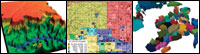
At the heart of a GIS is the ability to map, to graphically depict relationships between objects and data.


A costly product


The Lowdown

' What is it? GIS software allows the capture, storage, retrieval, analysis and display of spatial data in a variety of ways. It is used by local, state and federal government organizations, the military, telecommunications companies and public utilities, and is increasingly used by the health care, retail sales, real estate, insurance and tourist industries.


' How does it work? It collects geographic and other data and sorts it into separate layers, which can be combined into a single image that illustrates how divergent elements interact.


' When do you need it? You need GIS software if you require a sophisticated analysis of the ways geographic features, demographic information and other data interact.


' When don't you need it? When don't you need it? GIS is overkill for typical departmental briefings in which spreadsheets, pie charts or bar charts are good enough for putting data in graphical form.


' Must-know info? GIS developers are reaching out to nontechnical users with software for desktop PCs. Web-enabled GIS is the next big trend to watch, followed closely by location-based services over mobile devices, both for the consumer marketplace and specialized industries such as telecommunications, geothermal research, natural gas and oil.


www.opengis.org


It pays to know the foundation of a good GIS

A GIS program worth its salt should at minimum contain the following features, according to the Geological Survey:

' The ability to relate information from different sources. GIS mapping can input information from many different sources in many different forms.

' Digitized data. Regardless of the initial form of data, the software should digitize it for further editing.

' Data integration. It can link and then integrate information from various sources.

' Projection. A GIS should be able to adjust the scale of any map to that of any other map.

' Data compatibility. If data formats collected by a GIS are different, the software should make them compatible by restructuring them.

' Data modeling. A good GIS can depict two- and three-dimensional characteristics of the Earth's surface, subsurface and atmosphere from many information points and generate a map accordingly.

Release of a specification


www.web-mapper.com


J.B. Miles of Pahoa, Hawaii, writes about communications and computers. E-mail him at jbmiles@gte.net.


Desktop GIS Software Product Description Features Price
Applied Biomathematics

Setauket, N.Y.

631-751-4350

www.ramas.com
Ramas GIS 3.0 Ecological GIS software linking landscape data with population viability for endangered animal species Imports landscape data from a GIS, identifies habitat patches, builds a metapopulation model, performs viability analysis and risk assessment, has a user-friendly interface $1,500 per single-user license.
Autodesk Inc.

San Rafael, Calif.

800-964-6432

www.autodesk.com
Autodesk GIS
Design Server 1.0
Enterprise GIS software combining Audodesk's enterprise server technology with the mapping and design capability of AutoCAD Map Uses standard open protocols, scales across multiple networks and applications, integrates with enterprise resource planning systems, serves thousands of concurrent users, generates object rules $6,500 per user
Cadcorp Inc.

Norwood, Mass.

781-551-2727

www.cadcorp.co.uk
Cadcorp SIS 5.2 Suite consisting of MapViewer, MapManager, MapEditor, Map-

Modeler modules; can be used as a desktop GIS, a developer kit or as an ActiveX control; is Web-enabled
Includes multiple GIS data and database formats, extensive support for map projections and coordinate systems, Thematic Mapping Wizard and OLE2 support; is OpenGIS-compliant $300 for MapViewer, $1,200 for MapManager, $2,200 for MapEditor, $2,700 for MapModeler, $4,200 for Active Server
Caliper Corp.

Newton, Mass.

617-527-4700

www.caliper.com
GIS+ 3.5,
Maptitude 4.2
GIS+ 3.5: GIS software with tools that create and maintaingeographic databases, develop spatial analysis, data visualizationand custom mapping. Maptitude 4.2: CD-based software for U.S. streets, and U.S. and world geographic data GIS+ 3.5 comes with 32-bit Windows code, client-server processing and geographic database support; interfaces with multiple data collection tools, including GPS; manages digital orthophotography and satellite maps $2,995 per license for GIS+ 3.5; $395 per CD set for Maptitude 4.2
Caris Ltd.

Fredericton, New Brunswick

506-458-8533

www.caris.com
LIS/GIS Suite 4.4 Suite with Land Information Systems and Geographic InformationSystems software Includes Internet GIS, Spatial Fusion, Spatial Fusion Developer, Land Information Systems and Spatial Application Development tools, including ActiveX controls $635 to $5,000
ComGrafix Inc.

Clearwater, Fla.

727-585-7799

www.comgrafix.com
MapGrafix 4.0.1 GIS utility linking text and graphic map features with database infor-mation to relate descriptive data to specific geographic locations Supports real-world coordinate systems, uses intelligent cartographic data structures, supports standard vector formats, imports raster images into TIFF, has open architecture for customized applications, has comprehensive editing functions $995
Erdas Inc.

Atlanta

404-248-9000

www.erdas.com
Imagine 8.4 GIS suite with mapping, visualization, imaging, remote sensingand advanced imaging analysis Includes model layer enhancement, fog layer, 3-D shapefile support, hyperlinks, logo layer, enhanced 3-D DXF support and optional modules for NOAA satellite data support and Landsat 7 data $2,000 up
Environmental Systems
Research Institute


Redlands, Calif.

714-793-2853

www.esri.com
ArcView 8.1, B4

ArcView GIS 3.2
ArcView 8.1: desktop visualization, query, analysis, and basicgeographic data automation; ArcView GIS 3.2: ESRI's basiccustomizable desktop mapping and spatial analysis program ArcView 8.1 can be used as a standalone desktop GIS and as the entry point to ArcView GIS 3.2 while adding features such as ArcCatalog for managing data, on-the-fly coordination and data projection, and customization with Visual Basic for Applications $1,500 per license for ArcView 8.1; $1,195 per license for ArcView GIS 3.2
Geonomics Inc.

Boston

617-451-2520

www.geonomicsinc.com
iSite4.0 GIS mapping and demographics software Is bundled with Caliper's Maptitude 4.0 and other optional modules for determining best commercial or building site locations $695 for iSite 4.0; $1,995 for complete package
GeoSQL Technologies Inc.

Calgary, Alberta

403-263-3311

www.geosql.com
GeoSQL 5.51 Standalone desktop GIS software Works with major GIS formats, including ESRI, MapInfo and Autodesk; provides seamless spatial data using a SQL database that supports ODBC $299
IBIS Software Inc.

Portland, Ore.

503-249-3240

www.ibissoftware.com
Pangeo Response 2.0 Modular, entry-level GIS software Includes Pangeo Desktop, an image display and drawing tool, and Pangeo Publisher, which permits displaying images of unlimited size on the Internet $990
Intergraph Corp.

Huntsville, Ala.

800-791-3357

www.intergeraph.com/gis
GeoMedia 4.0 Suite with GeoMedia and GeoMedia Professional GIS, Web Mapand Web Enterprise Includes expanded data server support, integrated plotting workflow, data capture tools visual authoring and application generation tools for the Web, dynamic segmentation analysis, support for wireless GIS and support for a range of SQL servers $1,500 up
MapInfo Corp.

Troy, N.Y.

518-285-6000

www.mapinfo.com
MapInfo
Professional 6.0
Mapping program Includes Internet support, 3-D viewing capabilities, enhanced data access via Oracle8i Spatial and Microsoft Access2000, and improved printing capabilities $1,495
NAC Geographic
Products Inc.


Toronto

416-496-6110

www.nacgeo.com
NACGIS 2.0 Graphical editing software Includes mouse-controlled and graphic object drawing tools, graphic object manipulation tools, map viewing tools with longitude and latitude, and document editing $999
PCI Geomatics

Arlington, Va.

703-351-3317

www.pci-pacific.com
PAMAP GIS 5.2b Toolset for analyzing point, vector and area information Includes Mapper with data input, editing, display and query tools; Analyzer with statistical reports, Topographer for 3-D analysis and visualization; Networker for building network topologies, Modeler for complex model design, and GIS translators and filters $4,000
Tadpole-Cartesia

Carlsbad, Calif.

760-929-0992

www.conic.com
Conic 4.2 Field-based GIS software that uses portable pen computers Includes Mapbook for map viewing and navigation, Redline for redlining and sketching, Inspection for database access and updates, Survey for links to external equipment and Mobile Records for record-keeping $395 up per license; leasing

available
TCI Software Corp.

Baker City, Ore.

800-291-7533

www.tcicorp.com
MapTools
Professional 4.0
Collection of high-end tools for automating map preparation, cleanup and maintenance Is compatible with AutoCAD releases 14 and 2000; includes more than 100 automated map editing functions $995
ThinkSpace Inc.

London, Ontario

800-342-1335

www.thinkspace.com
Mfworks 2.6 Latest version of in ThinkSpace's line of raster GIS software Analyzes and visualizes spatial data, complements most commercial GIS programs, includes advanced cross-platform raster mapping, Classify Operation, Incremental Operations, AutoAlign and AutoResolution modules $900
Understanding Systems Inc.

Raleigh, N.C.

919-515-3829

www.undersys.com
oasisGIS Umbrella suite containing mapping software that functions between desktop and enterprise mapping systems Consists of the oasisCountyMapper for analyzing countywide map data; oasisDeedPro+ for writing, reading and plotting legal descriptions; oasisTopoMetris with algorithms for 3-D terrain analysis and visualization $895 up
Urban Information
Systems Inc.


San Diego

619-563-8726

www.u-i-s.com
Total Alignment
System
Comprehensive set of image manipulation tools
for use with ESRI's ArcView GIS 3.2
TAS Basic includes resources for controlling image theme scaling, moving, rotation calculation, georeferencing and World file creation; TAS Advanced adds true image rotation to the package $295 for both


X
This website uses cookies to enhance user experience and to analyze performance and traffic on our website. We also share information about your use of our site with our social media, advertising and analytics partners. Learn More / Do Not Sell My Personal Information
Accept Cookies
X
Cookie Preferences Cookie List

Do Not Sell My Personal Information

When you visit our website, we store cookies on your browser to collect information. The information collected might relate to you, your preferences or your device, and is mostly used to make the site work as you expect it to and to provide a more personalized web experience. However, you can choose not to allow certain types of cookies, which may impact your experience of the site and the services we are able to offer. Click on the different category headings to find out more and change our default settings according to your preference. You cannot opt-out of our First Party Strictly Necessary Cookies as they are deployed in order to ensure the proper functioning of our website (such as prompting the cookie banner and remembering your settings, to log into your account, to redirect you when you log out, etc.). For more information about the First and Third Party Cookies used please follow this link.

Allow All Cookies

Manage Consent Preferences

Strictly Necessary Cookies - Always Active

We do not allow you to opt-out of our certain cookies, as they are necessary to ensure the proper functioning of our website (such as prompting our cookie banner and remembering your privacy choices) and/or to monitor site performance. These cookies are not used in a way that constitutes a “sale” of your data under the CCPA. You can set your browser to block or alert you about these cookies, but some parts of the site will not work as intended if you do so. You can usually find these settings in the Options or Preferences menu of your browser. Visit www.allaboutcookies.org to learn more.

Sale of Personal Data, Targeting & Social Media Cookies

Under the California Consumer Privacy Act, you have the right to opt-out of the sale of your personal information to third parties. These cookies collect information for analytics and to personalize your experience with targeted ads. You may exercise your right to opt out of the sale of personal information by using this toggle switch. If you opt out we will not be able to offer you personalised ads and will not hand over your personal information to any third parties. Additionally, you may contact our legal department for further clarification about your rights as a California consumer by using this Exercise My Rights link

If you have enabled privacy controls on your browser (such as a plugin), we have to take that as a valid request to opt-out. Therefore we would not be able to track your activity through the web. This may affect our ability to personalize ads according to your preferences.

Targeting cookies may be set through our site by our advertising partners. They may be used by those companies to build a profile of your interests and show you relevant adverts on other sites. They do not store directly personal information, but are based on uniquely identifying your browser and internet device. If you do not allow these cookies, you will experience less targeted advertising.

Social media cookies are set by a range of social media services that we have added to the site to enable you to share our content with your friends and networks. They are capable of tracking your browser across other sites and building up a profile of your interests. This may impact the content and messages you see on other websites you visit. If you do not allow these cookies you may not be able to use or see these sharing tools.

If you want to opt out of all of our lead reports and lists, please submit a privacy request at our Do Not Sell page.

Save Settings
Cookie Preferences Cookie List

Cookie List

A cookie is a small piece of data (text file) that a website – when visited by a user – asks your browser to store on your device in order to remember information about you, such as your language preference or login information. Those cookies are set by us and called first-party cookies. We also use third-party cookies – which are cookies from a domain different than the domain of the website you are visiting – for our advertising and marketing efforts. More specifically, we use cookies and other tracking technologies for the following purposes:

Strictly Necessary Cookies

We do not allow you to opt-out of our certain cookies, as they are necessary to ensure the proper functioning of our website (such as prompting our cookie banner and remembering your privacy choices) and/or to monitor site performance. These cookies are not used in a way that constitutes a “sale” of your data under the CCPA. You can set your browser to block or alert you about these cookies, but some parts of the site will not work as intended if you do so. You can usually find these settings in the Options or Preferences menu of your browser. Visit www.allaboutcookies.org to learn more.

Functional Cookies

We do not allow you to opt-out of our certain cookies, as they are necessary to ensure the proper functioning of our website (such as prompting our cookie banner and remembering your privacy choices) and/or to monitor site performance. These cookies are not used in a way that constitutes a “sale” of your data under the CCPA. You can set your browser to block or alert you about these cookies, but some parts of the site will not work as intended if you do so. You can usually find these settings in the Options or Preferences menu of your browser. Visit www.allaboutcookies.org to learn more.

Performance Cookies

We do not allow you to opt-out of our certain cookies, as they are necessary to ensure the proper functioning of our website (such as prompting our cookie banner and remembering your privacy choices) and/or to monitor site performance. These cookies are not used in a way that constitutes a “sale” of your data under the CCPA. You can set your browser to block or alert you about these cookies, but some parts of the site will not work as intended if you do so. You can usually find these settings in the Options or Preferences menu of your browser. Visit www.allaboutcookies.org to learn more.

Sale of Personal Data

We also use cookies to personalize your experience on our websites, including by determining the most relevant content and advertisements to show you, and to monitor site traffic and performance, so that we may improve our websites and your experience. You may opt out of our use of such cookies (and the associated “sale” of your Personal Information) by using this toggle switch. You will still see some advertising, regardless of your selection. Because we do not track you across different devices, browsers and GEMG properties, your selection will take effect only on this browser, this device and this website.

Social Media Cookies

We also use cookies to personalize your experience on our websites, including by determining the most relevant content and advertisements to show you, and to monitor site traffic and performance, so that we may improve our websites and your experience. You may opt out of our use of such cookies (and the associated “sale” of your Personal Information) by using this toggle switch. You will still see some advertising, regardless of your selection. Because we do not track you across different devices, browsers and GEMG properties, your selection will take effect only on this browser, this device and this website.

Targeting Cookies

We also use cookies to personalize your experience on our websites, including by determining the most relevant content and advertisements to show you, and to monitor site traffic and performance, so that we may improve our websites and your experience. You may opt out of our use of such cookies (and the associated “sale” of your Personal Information) by using this toggle switch. You will still see some advertising, regardless of your selection. Because we do not track you across different devices, browsers and GEMG properties, your selection will take effect only on this browser, this device and this website.